
Dr Brian Glazer – Emerging Technologies to Enable Affordable Ocean Observing
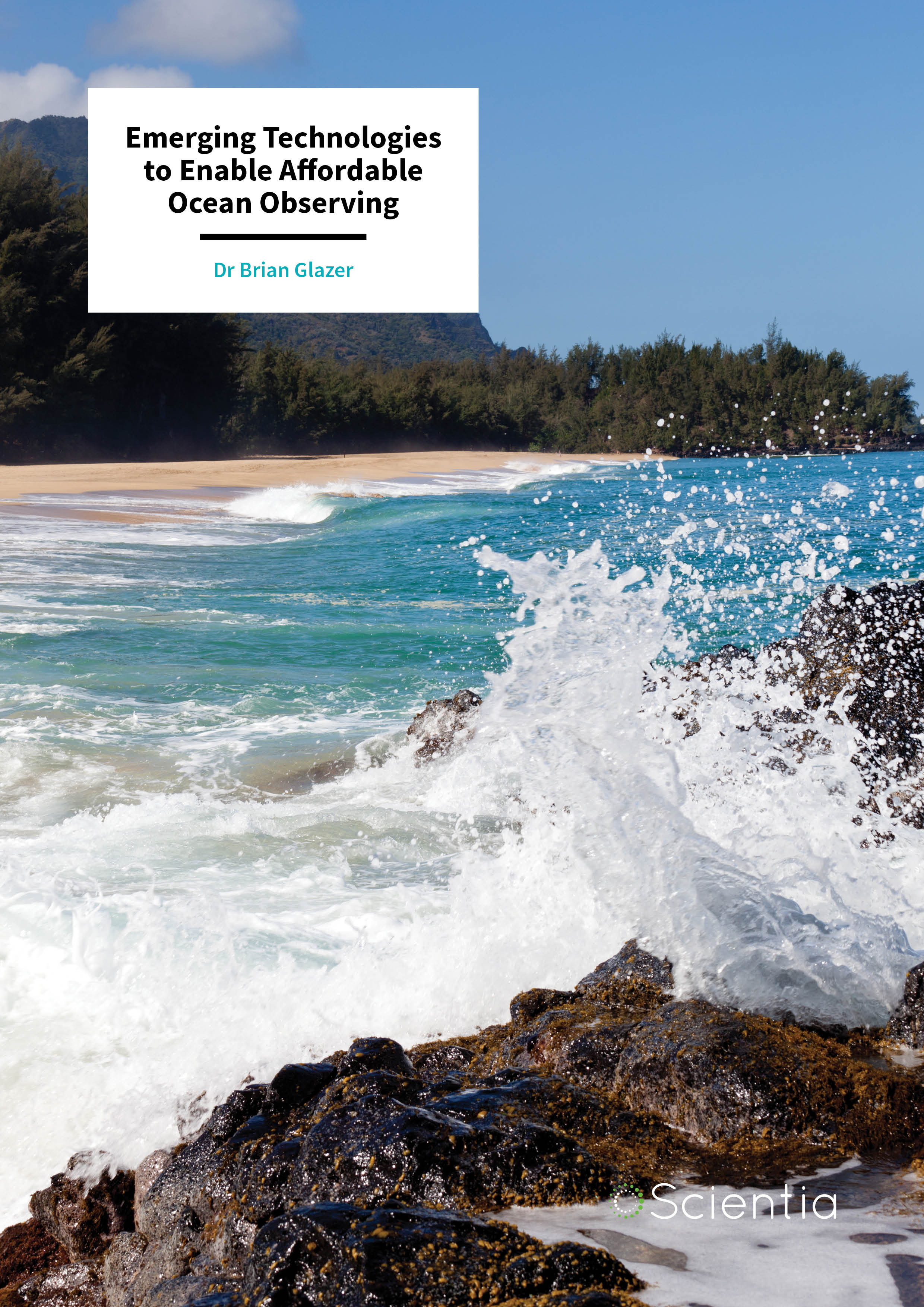
Coastal environments have immense ecological, practical, recreational and cultural value, and are under threat from multiple natural and anthropogenic stressors. Dr Brian Glazer and his team at the University of Hawai’i use specialised equipment to conduct remote coastal ‘health checks’ (smartcoastlines.org). They are also working to put the data directly into the hands of the public to encourage community-based management initiatives.
Coastal Zone Management
Government agencies and several community-based organisations are working tirelessly to ensure that our coastlines are resilient – and with good reason. We need to protect our environmental and natural assets for generations to come. Failure to do so could indeed have long-lasting effects as these finely tuned ecosystems could easily be ruined. Many of these sites also have cultural and practical fishing and aquaculture significance.
There are specific characteristics of the coastal environment that need to be monitored and managed more effectively, including indicators of water quality, coastal flooding and erosion, and environmental restoration activities. Each of these has an associated indicator of health that can be measured and monitored on a regular basis but doing so is typically cost-prohibitive for most community groups. Of course, scientists are always trying to find ways in which the monitoring process can be improved. This is especially true as the technology available to scientists is becoming increasingly powerful and diverse. Moreover, greater demands are being placed upon coastal areas by industry, economic development and an increasing population.
Dr Brian Glazer’s lab at the University of Hawai’i’s Department of Oceanography has been investigating the various applications of new lower-cost electronic, computing, and sensor technologies to carry out remote coastal ‘health checks’ in real time. Their work focuses on monitoring water temperature, salinity, dissolved oxygen and turbidity – as well as tidal variability, flooding and other meteorological events. In a nutshell, regular health checks and a faster response to environmental stressors means a better chance of mitigating environmental damage.
Dr Glazer is also working to ensure that the information gathered from these systems is available not only to researchers, but also to students and members of the public. Doing so allows them to participate in rigorous, crowd-sourced ‘citizen science’. When students and community members have first-hand access to demystified sensor and instrument technology that provides data for their own local environments, they become more informed about environmental issues that affect their community, and tend to become involved in conservation and management efforts. With funding from the National Science Foundation, NOAA Sea Grant, the University of Hawaii at Mānoa, and Schmidt Marine Technology Partners, Dr Glazer has established an open-source, expandable suite of hardware and online data-streaming platform for lower-cost, custom field observations (smartcoastlines.org).
A Foundation in Research
Dr Glazer’s work is focused on the interface between chemistry and biology in the oceans. Much of his work has focused on processes at the seafloor, from nearshore sediment-water interface fluxes to deep-sea volcanoes. All of these features are part of complex ecosystems and food chains, and many of the fundamental interactions between chemistry and biology that happen at deep-sea volcanoes also happen along gradients in coastal zones. Changes or damage to these fundamental aspects of an oceanic environment could have serious negative flow-on effects.
E-book
Audio-book

Reference
https://doi.org/10.33548/SCIENTIA330
Share
 Within this broader research context, Dr Glazer and his team are developing task-specific sensors and instrumentation for collecting and communicating data from remote locations. This practice is broadly referred to as telemetry. Telemetry is the automated communications process by which data is collected at remote locations, transmitted to receivers, processed and used for monitoring purposes.
The Benefits of Remote Oceanography
Of course, the information collected by scientists varies according to the research goals and nature of the monitoring site. There really is an amazing range of features that can be measured, and these measurements can tell scientists a whole range of different things about the site. As was mentioned at the outset, Dr Glazer focuses on tests that are most applicable to a given watershed, such as water quality parameters, tidal variability, flooding events and other meteorological events.
Consider how some of these tests could be beneficial to the public. Meteorological data may indicate impending weather events or how observed tidal fluctuations may differ from predicted tide levels, or in the longer-term, may be a commentary on a changing climate. Others are potential indicators of the relative waterway health. Turbidity (water cloudiness) or dropping levels of dissolved oxygen, for example, may be an indicator of pollution. For aquaculture communities, it could be a precursor to conditions that would lead to fish kills. Therefore, it is easy to see why measurements made at remote sensing sites would be beneficial, especially in terms of assisting communities in their quest to take care of their local environment.

Making Oceanographic Monitoring Accessible to All
Dr Glazer’s smartcoastlines.org project provides a holistic approach to democratising access to ocean observing technology. Commonly, government initiatives may support large, expensive programs to monitor and understand environmental processes, but the expensive commercially-available instruments and complex data streams have really only been developed for use by highly-trained and cashed-up scientists. Even undergraduate research assistants, graduate students and postdoctoral fellows in highly productive marine science departments are intimidated by expensive and complex commercially-available sensors and instruments. Such technologies are as foreign to non-experts as Mars Rover technology. But they need not be.
Dr Glazer’s group develops and tests inexpensive dataloggers with integrated telemetry capabilities and adapts an appropriate level of sensor accuracy, precision, expense for the appropriate application. There’s little need to deploy expensive conductivity sensors that can measure four decimal places of accuracy in a location that may experience a 30% daily fluctuation, if lower-cost sensors can provide more measurements in more places to better understand spatial questions.
The smartcoastline.org project was initiated to address the situation described above. Its goals are: (1) to develop and deploy wireless coastal instrumentation to provide near-real-time web-based data from key environmental sites for both basic research and public engagement interests; (2) to provide open-source instrumentation and sensors, open-source software, and quality assured time-series data; (3) to develop a ‘mentored citizen science’ approach for training proactive local non-profit collaborators and enabling program participants to deploy, maintain, and use data from sensor packages and; (4) to coordinate state-wide coastal watershed restoration efforts by matching community-based efforts with previously unavailable spatial-scale sensor data.
smartcoastlines.org in Action
Dr Glazer highlights that with the increasing availability of low-cost, open-source and compact computers, sensors and supporting telemetry solutions, these goals are well within reach. In fact, it is well underway at sites around the Hawaiian Islands. The data being collected is available in real-time, providing web access to an amazing array of unique measurements and data sets on unprecedented spatial scales. Of course, the end goal is not just to arbitrarily capture data, but also to use the data to monitor and predict processes that affect the health of aquatic systems and inform decision-making processes.
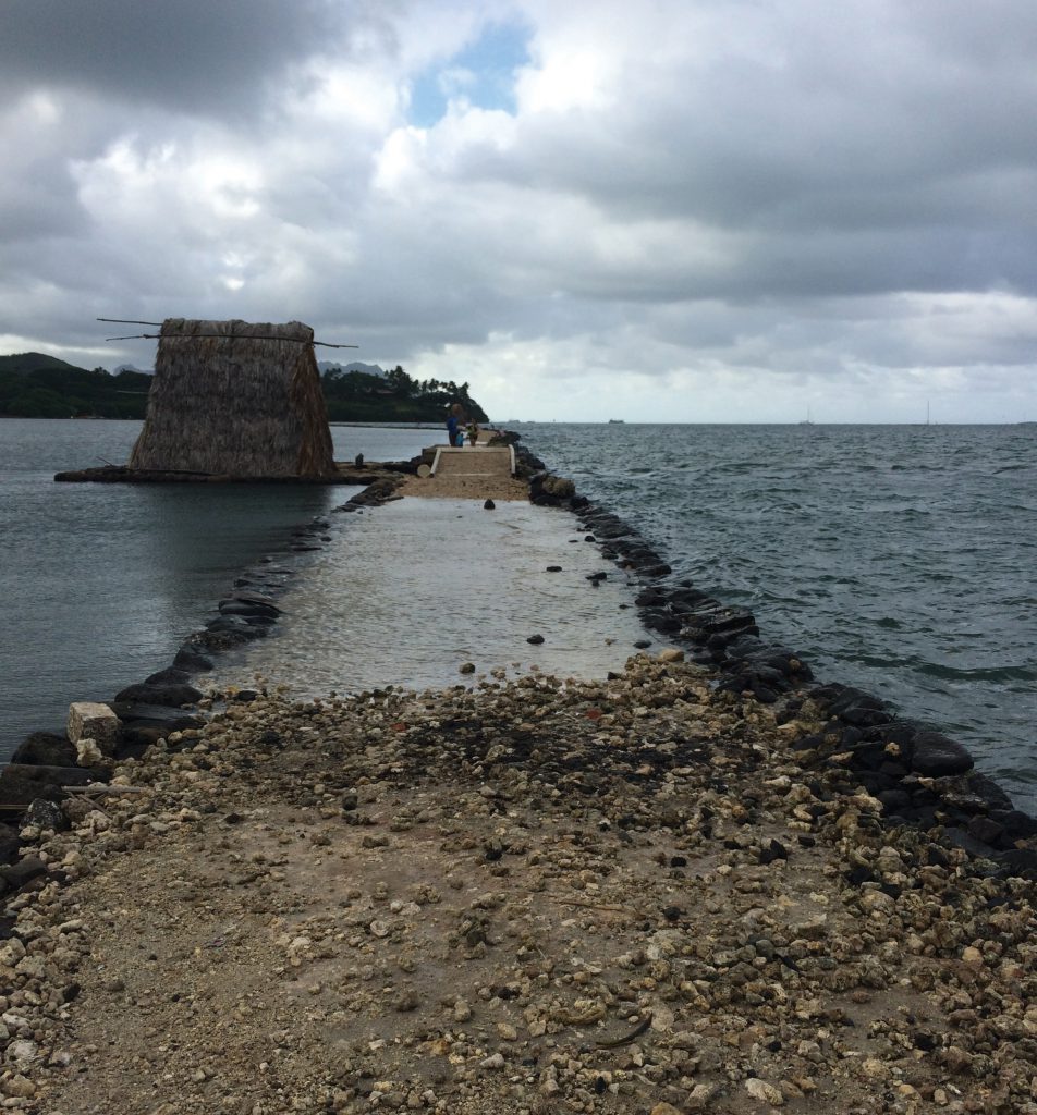
Consider an example. As Dr Glazer highlights, Loko i’a (traditional coastal Hawaiian fishponds) represent a long-lasting example of one of the ancient world’s more significant and successful aquaculture achievements. Today, they provide an ideal opportunity for coastal research and development of technological innovations. They are also an area of proactive community-based restoration projects. Unfortunately, most Hawaiian fishponds are largely in disrepair due to threats from land-use changes resulting in sediment and nutrient loading, encroaching development, and abundant invasive plant and animal species that have displaced native organisms.
In response, Dr Glazer and his team partnered with Paepae o He’eia – a private non-profit organisation dedicated to caring for the He’eia Fishpond, located in He’eia, Ko’olaupoko, O’ahu. Their goal was to implement this wireless coastal sensor network in the He’eia Fishpond to assist with measuring environmental restoration and management efforts, and to engage high-school and undergraduate students in related conservation. Initial work piloted at He’eia has now expanded to 18 other coastal restoration organisations throughout the state, and students have used the data captured in many research projects to quantify how contemporary threats to the coast are affecting pond restoration efforts.

Citizen Science and Community Involvement
‘Understanding the dynamics of coastal systems from a basic research perspective requires a sustained measurement presence in situ; especially in the face of increasing threats from extreme weather events, climate hazards, and changing ocean conditions,’ explains Dr Glazer. ‘Verifiable, consistent, and comparable datasets and observations are the foundation of environmental science, and crucial for enabling science-based policy and management decisions. However, restoration and stewardship are often limited by inadequate water quality data and poor understanding of watershed-scale processes resulting from a limitation in collecting, analysing, compiling and comparing data.’
He concludes, ‘having continuous time-series environmental datasets across wide spatial scales available to researchers and to non-scientists can help inform meaningful management decisions during restoration activities and as watersheds face differing environmental, land-use, or climate-related stressors.’ And that’s exactly what the smartcoastlines.org project achieves. It provides the tools, techniques and information for researching the coastal marine environment. Furthermore, it makes highly specialised equipment and real-time data available to anyone interested in the oceanographic and meteorological conditions across the Hawaiian Islands.
As for future work, Dr Glazer and his colleagues are set to make further additions and improvements to the program. They are expanding to additional field sites around the world. And to re-iterate, he wants to make sure that the data gathered is accessible to not only researchers, but also to students and the public for community-based management initiatives. This will have an immediate positive impact – helping local communities to conserve and manage their most precious assets.
Meet the researcher

Dr Brian Glazer
Department of Oceanography
University of Hawai’i at Mānoa
Honolulu, HI
USA
Dr Brian Glazer received his PhD in marine studies from the University of Delaware, USA, in 2004. He subsequently joined the NASA Astrobiology Institute at the University of Hawai’i at Mānoa. In 2006, he joined the Department of Oceanography, where he currently serves as Associate Professor. His research goals are to develop an understanding of the synergy between geochemical processes and biological diversity and function, and to develop in situ measurement techniques and instrumentation. He also wants to ensure that the information acquired is accessible to the global community – especially those engaged in undergraduate, postgraduate and community-based research and conservation projects. His current focus, smartcoastlines.org, is facilitating democratisation of environmental monitoring and data dissemination with funding support from the National Science Foundation, NOAA Sea Grant, Schmidt Marine Technology Partners, and a UH Manoa Strategic Investment Initiative.
CONTACT
W: https://www.soest.hawaii.edu/oceanography/glazer/Brian_T._Glazer/Home.html
KEY COMMUNITY COLLABORATORS
Hui Mālama Loko I’a (http://kuahawaii.org/huimalamalokoia/)
Paepae o He’eia (https://paepaeoheeia.org)
Purple Maia Foundation (http://www.purplemaia.org)
FUNDING
US National Science Foundation (NSF)
NOAA Sea Grant
Schmidt Marine Technology Partners
UH Manoa Strategic Investment Initiative
Posner Family Foundation
![]()